The City in Fragments
Kent State University, College of Architecture and Environmental Design
Third-Year Undergraduate Architecture Design Studio
Students: Ndeye Bassel, Elle Campbell, Eric Campbell, Hannah Hotchkiss, Alexander Kelley, Owen McDougald, Zachary Miller, Olivia Muchewicz, Summer Nairn, Troy Oblack, Raz Rasmussen, Autumn Sariano, Siddhi Shah
The fabric of the city is a layering of time, people, culture, and the built environment. Over time these layers, through forces ranging from natural to political, become fragmented. The fragments of the city reflect periods of cultural, political, and economic shifts, racial inequity, and natural disaster (to name a few), which have led to urban blight, a housing crisis, and resource inequity. How can we use architecture to utilize the fragments of the city to fulfill a need for housing and social support that engages with the community itself?
The studio will be composed of three main projects. Beginning with analysis and reinterpretation of historical and current conditions through mapping and projecting, students will assess the barriers and boundaries that have created the fabric of your urban condition as well as that of our site area, St. Clair Superior in Cleveland, OH. Next, we will work directly (remotely) with community stakeholders to conduct site analysis. Students will work in groups to put together a collective document of research and analysis which will culminate in a charette to propose a neighborhood identity system along with a small streetscape intervention. This will be presented to the “clients”, the St. Clair Superior Development Committee. The third and final project will take the form of an architectural proposal for low-rise housing taking advantage of the availability of vacant parcels in the Cleveland Land Bank.
PROJECT 01: MAPPING + MAKING
Fragmentation in the landscape: Mapping and representation skills will be developed through a localized map making exercise, then further articulated by moving to our site area (St. Clair-Superior) and interpreting conditions and available data to translate into a 3D map model.


PROJECT 02: A SPACE FOR…
This assignment will first focus on the collection, analysis, and representation of neighborhood conditions—physical, cultural, political—past and present in order to propose future urban interventions. We will focus the research and analysis through a racial equity lens. Instead of simply looking at public transportation, investigate the history of access to transportation, has it increased or decreased as the neighborhood demographics have changed? How have conditions in the neighborhood been a result of historical (and current!) anti-racist policies and bias.
We will then catalog and categorize available vacant lots, looking for potential sites for a range of uses and programs, from community gardens, to multi-family housing, to playgrounds. These will be collected in a graphic medium that will allow sorting and mixing.
Finally, we will work directly (remotely) with community stakeholders to develop potential street and vacant lot interventions. Following a design charrette, students will propose small streetscape interventions. This will be presented to the “clients”, the St. Clair Superior Development Committee.
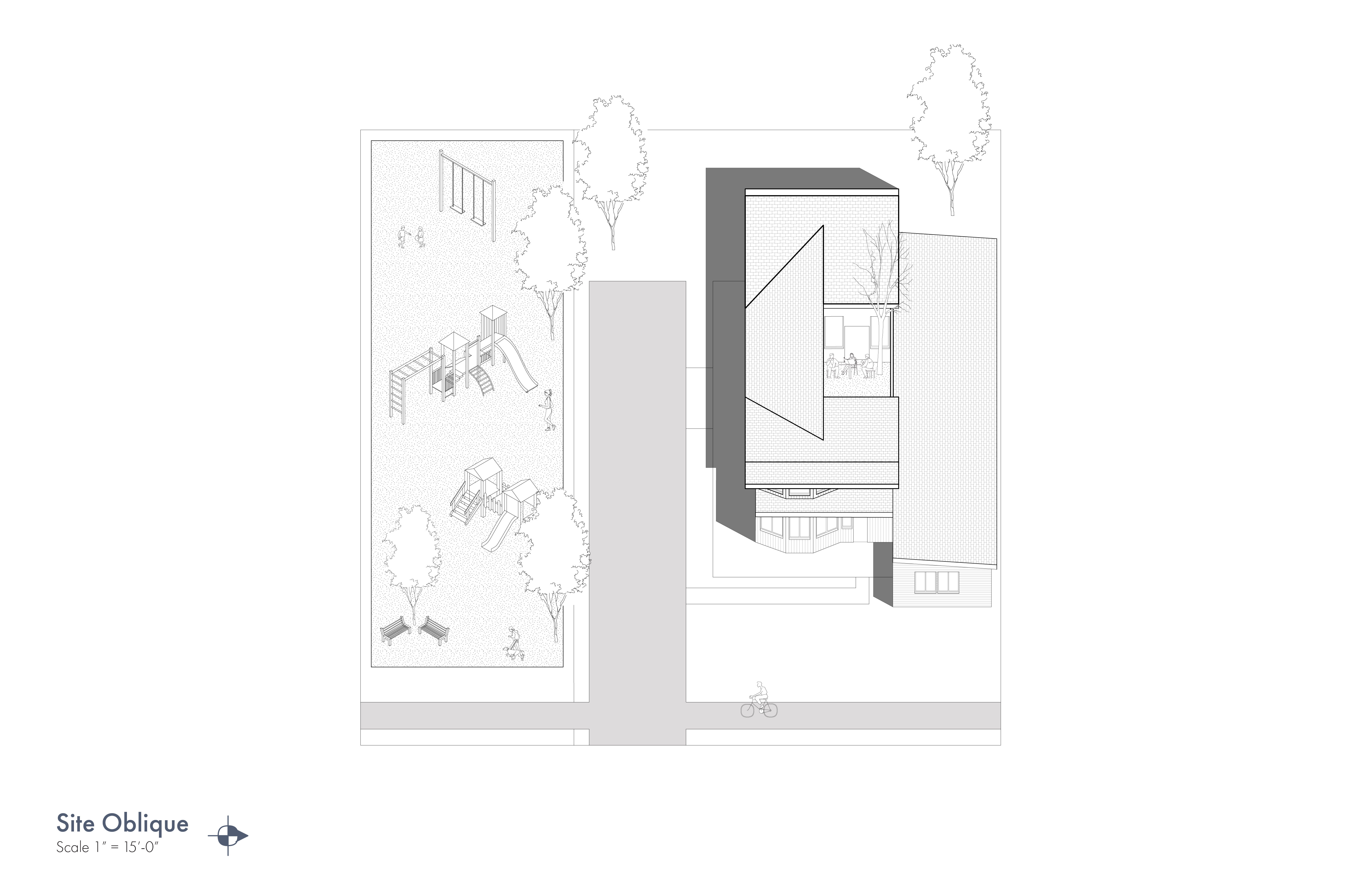
PROJECT 03: LIVING
We will look at two models of multi-family development, the traditional duplex, as well as the accessory dwelling unit (ADU or granny flat). The housing is required to accommodate two families, which are multigenerational. You must design for accessibility and considerations for aging needs. As a continuation of Project 02 you will be designing the housing to combine with the public program you proposed. Consider the implications of the proposal + housing.